Hurrikánok és tájfunok
Hasznos linkek
>> National Hurricane Center>> Joint Typhoon Warning Center
>> Weather Underground
>> Tropical Tidbits
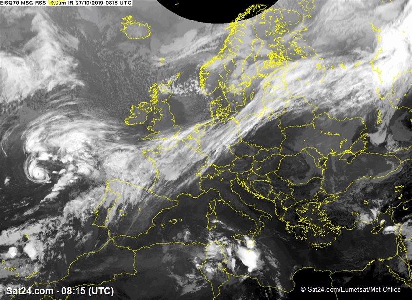
Az még hagyján, Grace is elment majdnem Írországig TS-ként, de Pablo közben erősödik is, majdhogynem hurrikán.
"The most recent Dvorak satellite intensity estimate was T3.0,which was held down due to constraints even though the eye pattern supports an intensity of 65 kt. Latest UW-CIMSS objective ADT and SATCON intensity estimates are T4.4/75 kt and 64 kt, respectively. Based on a blend of the TAFB and UW-CIMSS values, along with the 5- to 8-nmi-diameter eye, the intensity has been increased to 60 kt, which could be conservative due to the the cyclone's relatively fast forward speed."
"The most recent Dvorak satellite intensity estimate was T3.0,which was held down due to constraints even though the eye pattern supports an intensity of 65 kt. Latest UW-CIMSS objective ADT and SATCON intensity estimates are T4.4/75 kt and 64 kt, respectively. Based on a blend of the TAFB and UW-CIMSS values, along with the 5- to 8-nmi-diameter eye, the intensity has been increased to 60 kt, which could be conservative due to the the cyclone's relatively fast forward speed."


